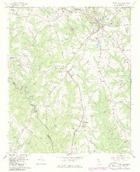
1964 Map of Watkinsville
USGS Topo · Published 1986About this map
The Central of Georgia railroad corridor serves as the primary spine for development across this Oconee County landscape, linking the settlements of Watkinsville, Bishop, and Farmington. At the northern edge, the U S Dept of Agriculture Southern Piedmont Experimental Station marks a significant institutional presence near the county seat. The rural character of the mid-1960s is preserved through the numerous family-named landmarks and local institutions, including Stroud Sch and County High Sch.
Find a feature on this map
56 named features on this map. Tap any name to fly to it.
Don’t see what you’re looking for? This feature index may not catch every label — zoom into the map to look around manually.
Map Details
Editions of this 1964 Watkinsville Map
3 editions found
Other maps of this area

1896 · Monroe
USGS Topo · 1:125,000

1953 · Athens
USGS Topo · 1:250,000

1958 · Athens
USGS Topo · 1:250,000

1959 · Athens
USGS Topo · 1:250,000

1963 · Athens
USGS Topo · 1:250,000

1964 · Athens West
USGS Topo · 1:24,000

1964 · Barnett Shoals
USGS Topo · 1:24,000

1964 · High Shoals
USGS Topo · 1:24,000

1964 · Watkinsville
USGS Topo · 1:24,000
1964 · Statham
USGS Topo · 1:24,000