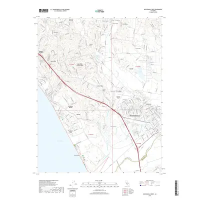
2018 Map of Watsonville West
USGS Topo · Published 2018About this map
Watsonville and its sprawling coastal wetlands anchor this 2018 survey, where the Pajaro River forms the southern boundary between Santa Cruz Co and Monterey Co. The landscape is defined by an intricate network of coastal waterways including Watsonville Slough, Harkins Slough, and Struve Slough, which weave through the agricultural flats and low-lying basins. Moving inland, the terrain ascends into the Aptos Hills and the southern reaches of the Santa Cruz Mountains, where communities like Day Valley and Pleasant Valley are tucked into the canyons. Genealogists will find three significant burial sites: Day Valley Cem, Pioneer Cem, and the Independent Order of Oddfellows Cem north of the city center. Aviation infrastructure is well-represented by both the Watsonville Municipal Airport and the coastal Monterey Bay Academy Airport near La Selva Beach.
Find a feature on this map
226 named features on this map. Tap any name to fly to it.
Don’t see what you’re looking for? This feature index may not catch every label — zoom into the map to look around manually.
Map Details
Editions of this 2018 Watsonville West Map
This is the sole edition of this map. No revisions or reprints were ever made.
Other maps of this area

1912 · Capitola
USGS Topo · 1:62,500

1914 · Capitola
USGS Topo · 1:62,500

1915 · San Juan Bautista
USGS Topo · 1:48,000

1916 · New Almaden
USGS Topo · 1:48,000

1917 · Morgan Hill
USGS Topo · 1:62,500

1917 · San Juan Bautista
USGS Topo · 1:62,500

1919 · New Almaden
USGS Topo · 1:62,500

1939 · Morgan Hill
USGS Topo · 1:62,500

1939 · San Juan Bautista
USGS Topo · 1:62,500

1940 · San Juan Bautista
USGS Topo · 1:62,500