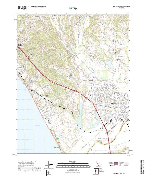
2021 Map of Watsonville West
USGS Topo · Published 2021About this map
The coastal agricultural landscape of southern Santa Cruz County is defined by the transition from the Santa Cruz Mountains down to Monterey Bay. This modern survey centers on Watsonville and the Pajaro Valley, a region where complex drainage networks like Watsonville Slough and Harkins Slough meet the fertile valley floor. The map highlights the intersection of transportation and community, from the northern Aptos Hills and Corralitos to the coastal reaches of Sunset Beach and La Selva Beach.
Find a feature on this map
40 named features on this map. Tap any name to fly to it.
Don’t see what you’re looking for? This feature index may not catch every label — zoom into the map to look around manually.
Map Details
Editions of this 2021 Watsonville West Map
This is the sole edition of this map. No revisions or reprints were ever made.
Other maps of this area

1912 · Capitola
USGS Topo · 1:62,500

1914 · Capitola
USGS Topo · 1:62,500

1915 · San Juan Bautista
USGS Topo · 1:48,000

1916 · New Almaden
USGS Topo · 1:48,000

1917 · Morgan Hill
USGS Topo · 1:62,500

1917 · San Juan Bautista
USGS Topo · 1:62,500

1919 · New Almaden
USGS Topo · 1:62,500

1939 · Morgan Hill
USGS Topo · 1:62,500

1939 · San Juan Bautista
USGS Topo · 1:62,500

1940 · San Juan Bautista
USGS Topo · 1:62,500