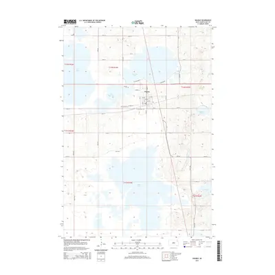
2015 Map of Waubay
USGS Topo · Published 2015About this map
Waubay serves as the central hub of this Day County landscape, situated on an isthmus between several expansive water bodies. The town's grid is bounded to the north by the shoreline of Blue Dog Lake and to the south by the extensive marshes of Bitter Lake. This geography creates a unique corridor for transportation, where W Yellowstone Trl and Railway Ave traverse the narrow land bridge.
Find a feature on this map
33 named features on this map. Tap any name to fly to it.
Don’t see what you’re looking for? This feature index may not catch every label — zoom into the map to look around manually.
Map Details
Editions of this 2015 Waubay Map
This is the sole edition of this map. No revisions or reprints were ever made.
Other maps of this area

1953 · Milbank
USGS Topo · 1:250,000

1958 · Milbank
USGS Topo · 1:250,000

1970 · Lonesome Lake
USGS Topo · 1:24,000

1970 · Waubay
USGS Topo · 1:24,000

1970 · Florence NE
USGS Topo · 1:24,000

1970 · Enemy Swim Lake East
USGS Topo · 1:24,000

1970 · Waubay SW
USGS Topo · 1:24,000

1970 · Roslyn
USGS Topo · 1:24,000

1970 · Ortley
USGS Topo · 1:24,000

1970 · Enemy Swim Lake West
USGS Topo · 1:24,000