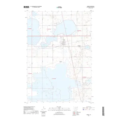
2017 Map of Waubay
USGS Topo · Published 2017About this map
Waubay sits at the heart of a complex glacial landscape in Day County, positioned between the expansive Blue Dog Lake and Little Rush Lake. This 2017 survey details a region dominated by its water bodies, including the massive Bitter Lake to the south and Rush Lake to the north. The town itself is structured around a traditional grid with streets like Railway Ave and Main St indicating its development alongside the railroad.
Find a feature on this map
44 named features on this map. Tap any name to fly to it.
Don’t see what you’re looking for? This feature index may not catch every label — zoom into the map to look around manually.
Map Details
Editions of this 2017 Waubay Map
This is the sole edition of this map. No revisions or reprints were ever made.
Other maps of this area

1953 · Milbank
USGS Topo · 1:250,000

1958 · Milbank
USGS Topo · 1:250,000

1970 · Lonesome Lake
USGS Topo · 1:24,000

1970 · Waubay
USGS Topo · 1:24,000

1970 · Florence NE
USGS Topo · 1:24,000

1970 · Enemy Swim Lake East
USGS Topo · 1:24,000

1970 · Waubay SW
USGS Topo · 1:24,000

1970 · Roslyn
USGS Topo · 1:24,000

1970 · Ortley
USGS Topo · 1:24,000

1970 · Enemy Swim Lake West
USGS Topo · 1:24,000