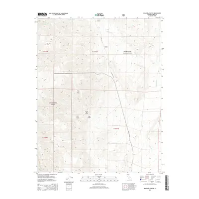
2015 Map of Waucoba Canyon
USGS Topo · Published 2015About this map
Death Valley National Park and Inyo National Forest meet in this high-elevation desert landscape, where the White- Inyo Range defines the vertical character of the terrain. The map centers on the high peak of Mt Inyo and the deep drainage of Waucoba Canyon, illustrating a region dominated by dramatic alluvial features like Waucoba Wash. Transportation in this arid backcountry is limited to the lonely corridor of Waucoba Saline Rd, which threads between steep canyon walls. The naming of Bunker Hill Canyon and Lead Canyon suggests a history of mineral exploration and prospecting tucked into the side-drainages of the larger basin. This survey provides a contemporary look at the boundary between protected wilderness and forest lands, preserving the topographic detail of these remote California desert summits.
Find a feature on this map
15 named features on this map. Tap any name to fly to it.
Don’t see what you’re looking for? This feature index may not catch every label — zoom into the map to look around manually.
Map Details
Editions of this 2015 Waucoba Canyon Map
This is the sole edition of this map. No revisions or reprints were ever made.
Other maps of this area

1907 · Mt. Whitney
USGS Topo · 1:125,000

1908 · Lida
USGS Topo · 1:250,000

1908 · Ballarat
USGS Topo · 1:250,000

1913 · Bishop
USGS Topo · 1:125,000

1913 · Lida
USGS Topo · 1:250,000

1913 · Ballarat
USGS Topo · 1:250,000

1919 · Mt. Whitney
USGS Topo · 1:125,000

1937 · Mt. Whitney
USGS Topo · 1:125,000

1947 · Mariposa
USGS Topo · 1:250,000

1948 · Death Valley
USGS Topo · 1:250,000