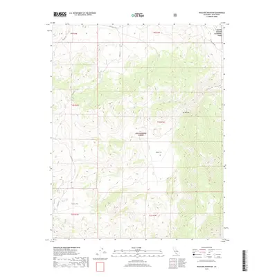
2018 Map of Waucoba Mountain
USGS Topo · Published 2018About this map
Papoose Flat dominates the high-elevation landscape of this 2018 survey, reflecting the complex topography where the Inyo National Forest meets the northwest corner of Death Valley National Park. This territory is defined by dramatic elevation changes and broad upland basins like Squaw Flat, connected by a sparse network of mountain thoroughfares including Death Valley Road and Waucoba Road. The map provides a detailed view of the natural corridors used for trans-mountain passage, such as The Narrows and the descending reaches of Marble Canyon. The absence of permanent settlements underscores the area's character as a protected wilderness, managed primarily for conservation and limited recreational access through various township and range jurisdictions.
Find a feature on this map
14 named features on this map. Tap any name to fly to it.
Don’t see what you’re looking for? This feature index may not catch every label — zoom into the map to look around manually.
Map Details
Editions of this 2018 Waucoba Mountain Map
This is the sole edition of this map. No revisions or reprints were ever made.
Other maps of this area

1907 · Mt. Whitney
USGS Topo · 1:125,000

1908 · Lida
USGS Topo · 1:250,000

1908 · Ballarat
USGS Topo · 1:250,000

1913 · Bishop
USGS Topo · 1:125,000

1913 · Lida
USGS Topo · 1:250,000

1913 · Ballarat
USGS Topo · 1:250,000

1919 · Mt. Whitney
USGS Topo · 1:125,000

1937 · Mt. Whitney
USGS Topo · 1:125,000

1947 · Mariposa
USGS Topo · 1:250,000

1948 · Death Valley
USGS Topo · 1:250,000