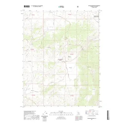
2021 Map of Waucoba Mountain
USGS Topo · Published 2021About this map
Inyo National Forest dominates this high-altitude landscape, where the eastern slopes of the Sierra Nevada transition into the arid peaks of the White-Inyo Range. This survey documents a wilderness of high basins and limestone canyons, most notably Marble Canyon and the geological pinch point known as The Narrows. Large alluvial features like Papoose Flat and Squaw Flat provide the few level stretches between significant summits such as Andrews Mtn and Waucoba Mtn. The map traces the rugged path of Death Valley Road as it skirts the northern boundary of Death Valley National Park, offering a window into the remote backcountry of Inyo County. A network of specialized Forest Service tracks, including the Squaw Flat Trl, reveals the infrastructure used to manage this high-desert environment in the modern era.
Find a feature on this map
32 named features on this map. Tap any name to fly to it.
Don’t see what you’re looking for? This feature index may not catch every label — zoom into the map to look around manually.
Map Details
Editions of this 2021 Waucoba Mountain Map
This is the sole edition of this map. No revisions or reprints were ever made.
Other maps of this area

1907 · Mt. Whitney
USGS Topo · 1:125,000

1908 · Lida
USGS Topo · 1:250,000

1908 · Ballarat
USGS Topo · 1:250,000

1913 · Bishop
USGS Topo · 1:125,000

1913 · Lida
USGS Topo · 1:250,000

1913 · Ballarat
USGS Topo · 1:250,000

1919 · Mt. Whitney
USGS Topo · 1:125,000

1937 · Mt. Whitney
USGS Topo · 1:125,000

1947 · Mariposa
USGS Topo · 1:250,000

1948 · Death Valley
USGS Topo · 1:250,000