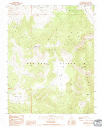
1990 Map of Waucoba Mtn
USGS Topo · Published 1995About this map
Inyo Mountains high country dominates this 1990 photo-inspected survey, revealing a landscape defined by significant elevation changes and isolated geological formations. The terrain rises to the prominent Waucoba Mountain and Andrews Mountain, while the expanse of Papoose Flat provides a rare level opening amidst the surrounding peaks. This area within the Inyo National Forest shows a history of mineral exploration, marked by scattered prospects and mines that suggest the region's long-standing appeal to prospectors. Access is limited to the Death Valley Road and rugged 4WD tracks, which navigate through dramatic features like The Narrows and the deep cuts of Marble Canyon. The lack of major culture or drainage changes noted in this era preserves the character of these high-altitude desert ranges during the late twentieth century.
Find a feature on this map
13 named features on this map. Tap any name to fly to it.
Don’t see what you’re looking for? This feature index may not catch every label — zoom into the map to look around manually.
Map Details
Editions of this 1990 Waucoba Mtn Map
This is the sole edition of this map. No revisions or reprints were ever made.
Other maps of this area

1907 · Mt. Whitney
USGS Topo · 1:125,000

1908 · Lida
USGS Topo · 1:250,000

1908 · Ballarat
USGS Topo · 1:250,000

1913 · Bishop
USGS Topo · 1:125,000

1913 · Lida
USGS Topo · 1:250,000

1913 · Ballarat
USGS Topo · 1:250,000

1919 · Mt. Whitney
USGS Topo · 1:125,000

1937 · Mt. Whitney
USGS Topo · 1:125,000

1947 · Mariposa
USGS Topo · 1:250,000

1948 · Death Valley
USGS Topo · 1:250,000