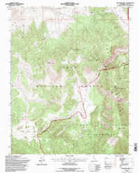
1994 Map of Waucoba Mtn
USGS Topo · Published 1997About this map
Waucoba Mountain and the high desert terrain of the Inyo Mountains dominate this mid-1990s survey. Much of the landscape is protected within the Inyo National Forest and the Inyo Mountains Wilderness, characterized by dramatic elevation changes across high-altitude plateaus like Papoose Flat, Whippoorwill Flat, and Squaw Flat.
Find a feature on this map
15 named features on this map. Tap any name to fly to it.
Don’t see what you’re looking for? This feature index may not catch every label — zoom into the map to look around manually.
Map Details
Editions of this 1994 Waucoba Mtn Map
This is the sole edition of this map. No revisions or reprints were ever made.
Other maps of this area

1907 · Mt. Whitney
USGS Topo · 1:125,000

1908 · Lida
USGS Topo · 1:250,000

1908 · Ballarat
USGS Topo · 1:250,000

1913 · Bishop
USGS Topo · 1:125,000

1913 · Lida
USGS Topo · 1:250,000

1913 · Ballarat
USGS Topo · 1:250,000

1919 · Mt. Whitney
USGS Topo · 1:125,000

1937 · Mt. Whitney
USGS Topo · 1:125,000

1947 · Mariposa
USGS Topo · 1:250,000

1948 · Death Valley
USGS Topo · 1:250,000