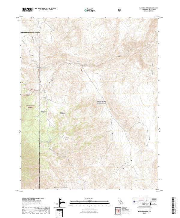
2021 Map of Waucoba Spring
USGS Topo · Published 2021About this map
Waucoba Spring serves as a vital water source in this arid high-elevation landscape where the White- Inyo Range meets the Saline Range. This 2021 survey reveals a complex network of high-desert basins and drainage systems, including Whippoorwill Flat and the expansive Jackass Flats. The terrain is defined by dramatic elevation changes through Marble Canyon, Opal Canyon, and Waucoba Canyon. Administrative boundaries are clearly marked, showing the transition between Inyo National Forest and Death Valley National Park. Transportation is limited to rugged tracks like Waucoba Road and forest routes such as 36e406 Tri, which navigate through North Pass. The map documents the persistent geography of these protected lands, where natural features like Whippoorwill Canyon dictate the movement of both modern travelers and those following ancient routes.
Find a feature on this map
23 named features on this map. Tap any name to fly to it.
Don’t see what you’re looking for? This feature index may not catch every label — zoom into the map to look around manually.
Map Details
Editions of this 2021 Waucoba Spring Map
This is the sole edition of this map. No revisions or reprints were ever made.
Other maps of this area

1907 · Mt. Whitney
USGS Topo · 1:125,000

1908 · Lida
USGS Topo · 1:250,000

1908 · Ballarat
USGS Topo · 1:250,000

1913 · Bishop
USGS Topo · 1:125,000

1913 · Lida
USGS Topo · 1:250,000

1913 · Ballarat
USGS Topo · 1:250,000

1919 · Mt. Whitney
USGS Topo · 1:125,000

1937 · Mt. Whitney
USGS Topo · 1:125,000

1947 · Mariposa
USGS Topo · 1:250,000

1948 · Death Valley
USGS Topo · 1:250,000