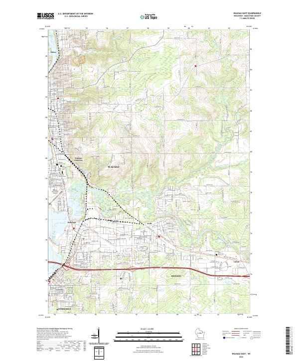
2022 Map of Wausau East
USGS Topo · Published 2022About this map
The Wausau urban landscape and its surrounding townships in Marathon County are shaped by the convergence of the Wisconsin River and the Eau Claire River. This contemporary survey reveals a complex network of residential and industrial development extending through Schofield, Weston, and Rothschild. The hydrology of the area is particularly prominent, featuring the Eau Claire Flowage and Lake Wausau, which reflect the region's long history of water management and river-dependent industry. Near the city's civic heart, the Marathon County Courthouse stands as a central landmark, while the Wausau Downtown Airport occupies a significant bend in the river south of the urban core.
Find a feature on this map
33 named features on this map. Tap any name to fly to it.
Don’t see what you’re looking for? This feature index may not catch every label — zoom into the map to look around manually.
Map Details
Editions of this 2022 Wausau East Map
This is the sole edition of this map. No revisions or reprints were ever made.
Other maps of this area

1899 · Wausau
USGS Topo · 1:125,000

1902 · Wausau
USGS Topo · 1:125,000

1951 · Doering
USGS Topo · 1:48,000

1951 · Merrill
USGS Topo · 1:48,000

1953 · Wausau
USGS Topo · 1:48,000

1953 · Hatley
USGS Topo · 1:48,000

1954 · Iron Mountain
USGS Topo · 1:250,000

1955 · Green Bay
USGS Topo · 1:250,000

1959 · Iron Mountain
USGS Topo · 1:250,000

1963 · Wausau West
USGS Topo · 1:24,000