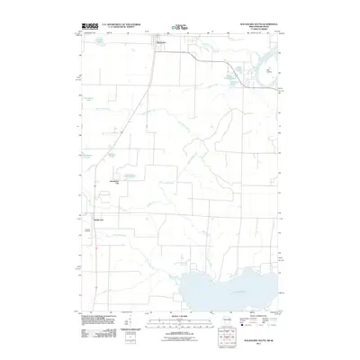
2011 Map of Wausaukee South
USGS Topo · Published 2011About this map
Wausaukee anchors the northern portion of this Marinette County landscape, where the Wausaukee River winds eastward toward its confluence with the Menominee River. The drainage patterns here are complex, defined by several forks including the Upper Middle Inlet, Middle Inlet, and Lower Middle Inlet, all feeding into the expansive waters of Lake Noquebay at the southern edge. This area is characterized by a high concentration of glacial lakes and wetlands, such as Wolf Lake, Finnegan Lake, and Roosevelt Lake, which dot the terrain between scattered rural settlements.
Find a feature on this map
22 named features on this map. Tap any name to fly to it.
Don’t see what you’re looking for? This feature index may not catch every label — zoom into the map to look around manually.
Map Details
Editions of this 2011 Wausaukee South Map
This is the sole edition of this map. No revisions or reprints were ever made.
Other maps of this area

1939 · Porterfield
USGS Topo · 1:48,000

1940 · Athelstane
USGS Topo · 1:48,000

1941 · Coleman
USGS Topo · 1:48,000

1942 · Athelstane
USGS Topo · 1:48,000

1942 · Coleman
USGS Topo · 1:48,000

1942 · Porterfield
USGS Topo · 1:48,000

1942 · Wausaukee
USGS Topo · 1:48,000

1947 · Wausaukee
USGS Topo · 1:48,000

1950 · Coleman
USGS Topo · 1:48,000

1954 · Iron Mountain
USGS Topo · 1:250,000