2023 Map of Waverly
USGS Topo · Published 2023About this map
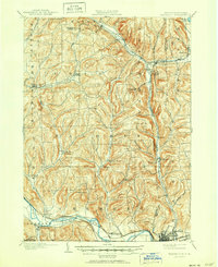
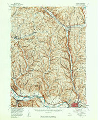
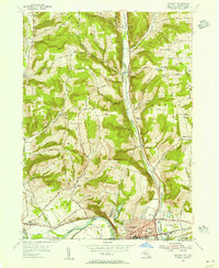
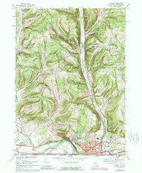
The Chemung River valley serves as the primary corridor for settlement and transit along the southern border of Tioga County, where the village of Waverly sits as a regional hub. This landscape is defined by the steep transition from the river basin to the high ridges of Putnam Hill and Tallmadge Hill, with numerous small watercourses like Cayuta Creek and Wynkoop Creek carving deep hollows through the terrain. The map details a dense network of local cemeteries including Drybrook Cem and Glenwood Cem, suggesting a long-established rural community fabric.
Find a feature on this map
141 named features on this map. Tap any name to fly to it.
Don’t see what you’re looking for? This feature index may not catch every label — zoom into the map to look around manually.
Map Details
Editions of this 2023 Waverly Map
This is the sole edition of this map. No revisions or reprints were ever made.
Historical Maps of Athens Township Through Time
5 maps found