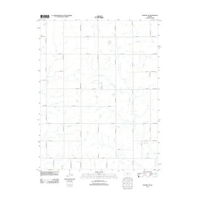
2012 Map of Waverly SE
USGS Topo · Published 2012About this map
Pottawatomie Cr meanders through the heart of this Anderson County landscape, joined by several smaller tributaries including Rock Cr, Elm Cr, and Long Cr. This early 21st-century survey reveals a strictly organized grid of rural section roads, such as Shetland Rd and Trefoil Rd Ne, which facilitate the agricultural movements of the region. The drainage patterns of Scott Cr and Crooked Cr in the southern portion of the sheet highlight the subtle contours of the terrain. The map reflects a modern rural environment where land use is closely tied to the watercourses and the established township-and-range road system, providing an accurate record of property access and hydrological features before more recent developments.
Find a feature on this map
41 named features on this map. Tap any name to fly to it.
Don’t see what you’re looking for? This feature index may not catch every label — zoom into the map to look around manually.
Map Details
Editions of this 2012 Waverly SE Map
This is the sole edition of this map. No revisions or reprints were ever made.
Other maps of this area

1885 · Burlington
USGS Topo · 1:125,000

1885 · Garnett
USGS Topo · 1:125,000

1894 · Garnett
USGS Topo · 1:125,000

1894 · Burlington
USGS Topo · 1:125,000

1947 · Lawrence
USGS Topo · 1:250,000

1950 · Lawrence
USGS Topo · 1:250,000

1956 · Williamsburg
USGS Topo · 1:24,000

1956 · Lawrence
USGS Topo · 1:250,000

1957 · Waverly NW
USGS Topo · 1:24,000

1957 · Waverly
USGS Topo · 1:24,000