
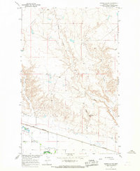
1964 Map of Wayne Creek SE
USGS Topo · Published 1967About this map
Wayne appears as a sparse settlement or landmark amidst the intricately carved coulees and drainage basins of central Blaine County during the mid-1960s. This survey, conducted as part of the Department of the Interior program for the development of the Missouri River Basin, reveals a landscape defined by seasonal water flow and technical resource extraction. Major water features including Savoy Creek, Wayne Creek, and Black Creek have cut deep, winding paths through the terrain, creating a complex topographic network that dictated the placement of early infrastructure. The presence of a Well and a Drill Hole alongside Mud Lake points to a period of active land use and geological exploration in this rural Montana region. Transportation is primarily limited to rugged routes like West Savoy Road and East Savoy Road, which follow the higher ground between the creek beds and smaller basins.
Find a feature on this map
12 named features on this map. Tap any name to fly to it.
Don’t see what you’re looking for? This feature index may not catch every label — zoom into the map to look around manually.
Map Details
Editions of this 1964 Wayne Creek SE Map
This is the sole edition of this map. No revisions or reprints were ever made.
Other maps of this area

1903 · Wayne Creek
USGS Topo · 1:62,500

1905 · Wayne Creek
USGS Topo · 1:62,500

1913 · Cherry Ridge
USGS Topo · 1:125,000

1920 · Avery
USGS Topo · 1:125,000

1953 · Havre
USGS Topo · 1:250,000

1957 · Havre
USGS Topo · 1:250,000

1958 · Havre
USGS Topo · 1:250,000

1964 · Threemile Reservoir
USGS Topo · 1:24,000

1964 · Coburg
USGS Topo · 1:24,000
1964 · Grable Coulee
USGS Topo · 1:24,000