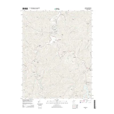
2014 Map of Wayne
USGS Topo · Published 2014About this map
Twelvepole Creek and the West Fork Twelvepole Creek wind through the heart of Wayne County, defining the settlement patterns of this central West Virginia landscape. The town of Wayne serves as a primary hub, situated near the northern edge where Toms Cr meets the main waterway. Local genealogy is well-documented across the terrain, with family-named sites such as Bailey Cem, Adkins Cem, and Ferguson Cem scattered among the hollows and ridges. The southern portion of the map is dominated by the reservoir of East Lynn Lake, which gathers the waters of the Right Fork Lynn Cr and Luster Fork. This landscape reflects a community deeply tied to its narrow valleys and ridges, with small settlements like Genoa, Sidney, and East Lynn connected by a network of rural roads that follow the winding paths of the numerous local branches.
Find a feature on this map
121 named features on this map. Tap any name to fly to it.
Don’t see what you’re looking for? This feature index may not catch every label — zoom into the map to look around manually.
Map Details
Editions of this 2014 Wayne Map
This is the sole edition of this map. No revisions or reprints were ever made.
Other maps of this area

1892 · Huntington
USGS Topo · 1:125,000

1898 · Huntington
USGS Topo · 1:125,000

1901 · Guyandot
USGS Topo · 1:62,500

1901 · Ceredo
USGS Topo · 1:62,500

1902 · Guyandot
USGS Topo · 1:62,500

1903 · Kenova
USGS Topo · 1:125,000

1904 · Kenova
USGS Topo · 1:125,000

1909 · Wayne
USGS Topo · 1:62,500

1911 · Louisa
USGS Topo · 1:48,000

1913 · Ceredo
USGS Topo · 1:62,500