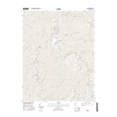
2016 Map of Wayne
USGS Topo · Published 2016About this map
Twelvepole Creek and its many winding tributaries dictate the landscape of this region, which was surveyed during a period of modern stability. The county seat at Wayne serves as the primary hub, where Wayne Cem sits just north of Asbury Rd. To the south, smaller communities like Genoa, Sidney, and East Lynn are linked by rural routes that follow the narrow valley floors. The presence of Old Nw Railroad Rd near Genoa suggests the historical path of heavy industry or transit that once shaped these hills.
Find a feature on this map
112 named features on this map. Tap any name to fly to it.
Don’t see what you’re looking for? This feature index may not catch every label — zoom into the map to look around manually.
Map Details
Editions of this 2016 Wayne Map
This is the sole edition of this map. No revisions or reprints were ever made.
Other maps of this area

1892 · Huntington
USGS Topo · 1:125,000

1898 · Huntington
USGS Topo · 1:125,000

1901 · Guyandot
USGS Topo · 1:62,500

1901 · Ceredo
USGS Topo · 1:62,500

1902 · Guyandot
USGS Topo · 1:62,500

1903 · Kenova
USGS Topo · 1:125,000

1904 · Kenova
USGS Topo · 1:125,000

1909 · Wayne
USGS Topo · 1:62,500

1911 · Louisa
USGS Topo · 1:48,000

1913 · Ceredo
USGS Topo · 1:62,500