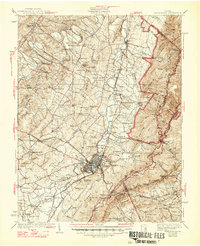
1939 Map of Waynesboro
USGS Topo · Published 1947About this map
Waynesboro serves as the industrial and transportation hub of this 1930s landscape, situated where the Norfolk and Western Railway intersects the Chesapeake and Ohio Railway. The map details a transition from the rolling valley floor, dotted with historic congregations like Old Stone Ch and Tinkling Spring Ch, to the steep rise of the George Washington National Forest. Engineering landmarks are prominent along the ridge, including the Greenwood Tunnel and Blue Ridge Tunnel providing passage through the mountains.
Find a feature on this map
122 named features on this map. Tap any name to fly to it.
Don’t see what you’re looking for? This feature index may not catch every label — zoom into the map to look around manually.
Map Details
Editions of this 1939 Waynesboro Map
3 editions found

Other maps of this area

1892 · Buckingham
USGS Topo · 1:125,000

1892 · Harrisonburg
USGS Topo · 1:125,000

1894 · Staunton
USGS Topo · 1:125,000

1894 · Lexington
USGS Topo · 1:125,000

1929 · Covesville
USGS Topo · 1:62,500

1931 · University
USGS Topo · 1:62,500

1934 · Waynesboro
USGS Topo · 1:48,000

1935 · Covesville
USGS Topo · 1:62,500

1935 · University
USGS Topo · 1:62,500

1936 · Vesuvius
USGS Topo · 1:48,000