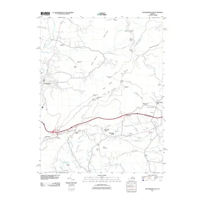
2011 Map of Waynesboro East
USGS Topo · Published 2011About this map
Rockfish Gap serves as a major transit nexus on this 2011 map, where the Blue Ridge Pkwy, Skyline Dr, and the Appalachian Trl converge at the crest of the Blue Ridge mountains. This map documents a landscape defined by its high-altitude infrastructure, including the historic Blue Ridge Tunnel and numerous scenic vistas like the McCormick Gap Overlook. The transition from the rugged slopes of Bear Den Mountain and Turk Mountain to the agricultural valleys is marked by small settlements and family estates such as Mirador and Rosehill. Local heritage is preserved in sites like the Emmanuel Cemetery and Mount Lebanon Cemetery, while the presence of the Eastside Speedway near Sawmill Run highlights the region's recreational culture. The map provides a detailed view of the evolving residential patterns in communities like Brookville Manor and Blue Ridge Acres.
Find a feature on this map
106 named features on this map. Tap any name to fly to it.
Don’t see what you’re looking for? This feature index may not catch every label — zoom into the map to look around manually.
Map Details
Editions of this 2011 Waynesboro East Map
This is the sole edition of this map. No revisions or reprints were ever made.
Other maps of this area

1892 · Buckingham
USGS Topo · 1:125,000

1892 · Harrisonburg
USGS Topo · 1:125,000

1929 · Covesville
USGS Topo · 1:62,500

1931 · University
USGS Topo · 1:62,500

1934 · Waynesboro
USGS Topo · 1:48,000

1935 · Covesville
USGS Topo · 1:62,500

1935 · University
USGS Topo · 1:62,500

1939 · Waynesboro
USGS Topo · 1:62,500

1943 · Lovingston
USGS Topo · 1:62,500

1945 · Covesville
USGS Topo · 1:62,500