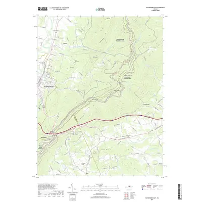
2019 Map of Waynesboro East
USGS Topo · Published 2019About this map
Waynesboro serves as the western anchor of this topographic study, where the urban grid meets the rising slopes of the Blue Ridge. The terrain is dominated by the massive crest of the mountains, transitioning from the South River valley up through Rockfish Gap. This high-altitude passage is a critical corridor for both nature and infrastructure, carrying the Blue Ridge Parkway, Skyline Dr, and the historic Blue Ridge Tunnel. To the east, the map traces the descent into the Piedmont toward Greenwood and Newtown. Significant cultural sites are dispersed across the ridges and hollows, including the Mount Lebanon Cem near Dooms and the Emmanuel Cem in the eastern foothills. The Appalachian National Scenic Trail winds along the heights, passing notable landmarks like Beagle Gap and Bear Den Mtn, highlighting the overlap of conservation land within Shenandoah National Park and the developed valley below.
Find a feature on this map
114 named features on this map. Tap any name to fly to it.
Don’t see what you’re looking for? This feature index may not catch every label — zoom into the map to look around manually.
Map Details
Editions of this 2019 Waynesboro East Map
This is the sole edition of this map. No revisions or reprints were ever made.
Other maps of this area

1892 · Buckingham
USGS Topo · 1:125,000

1892 · Harrisonburg
USGS Topo · 1:125,000

1929 · Covesville
USGS Topo · 1:62,500

1931 · University
USGS Topo · 1:62,500

1934 · Waynesboro
USGS Topo · 1:48,000

1935 · Covesville
USGS Topo · 1:62,500

1935 · University
USGS Topo · 1:62,500

1939 · Waynesboro
USGS Topo · 1:62,500

1943 · Lovingston
USGS Topo · 1:62,500

1945 · Covesville
USGS Topo · 1:62,500