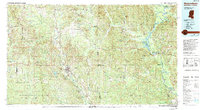
1984 Map of Waynesboro
USGS Topo · Published 1994About this map
The Chickasawhay River and the Pascagoula River define the watery network of this borderland region, where the pine-heavy reaches of the De Soto National Forest meet the fertile river bottoms of eastern Mississippi and western Alabama. In the mid-1980s, the Illinois Central Gulf RR remained a vital artery through the county seat of Waynesboro and smaller trackside hamlets like Shubuta and Hiwannee.
Find a feature on this map
68 named features on this map. Tap any name to fly to it.
Don’t see what you’re looking for? This feature index may not catch every label — zoom into the map to look around manually.
Map Details
Editions of this 1984 Waynesboro Map
2 editions found
Other maps of this area

1943 · Choctaw Bluff
USGS Topo · 1:62,500

1943 · McIntosh
USGS Topo · 1:62,500

1944 · McIntosh
USGS Topo · 1:62,500

1946 · Choctaw Bluff
USGS Topo · 1:62,500

1953 · Montgomery
USGS Topo · 1:250,000

1953 · Andalusia
USGS Topo · 1:250,000

1953 · Hattiesburg
USGS Topo · 1:250,000

1953 · Meridian
USGS Topo · 1:250,000

1956 · Montgomery
USGS Topo · 1:250,000

1957 · Meridian
USGS Topo · 1:250,000