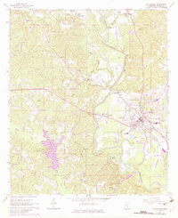
1964 Map of Waynesboro
USGS Topo · Published 1982About this map
Waynesboro serves as the focal point of this Mississippi landscape, situated at the crossroads of a significant timber and transport corridor. The Chickasawhay River meanders through the eastern portion of the sheet, paralleled by the Illinois Central Gulf railroad, which historically anchored the region's commerce. The map reflects a community defined by its rural institutions, with numerous country churches like Antioch Ch and West King Ch and family-named burial sites such as Mozingo Cem and Dyers Cem marking the terrain. A notable feature of the landscape is the Maynor Creek Water Park, where the impounded Maynor Creek creates a large reservoir system. Industrial activity is evident through various Gravel Pit operations and a nearby Oil Field, while the Wayne Lookout Tower stands as a sentinel over the surrounding pine forests.
Find a feature on this map
51 named features on this map. Tap any name to fly to it.
Don’t see what you’re looking for? This feature index may not catch every label — zoom into the map to look around manually.
Map Details
Editions of this 1964 Waynesboro Map
2 editions found
Other maps of this area

1953 · Hattiesburg
USGS Topo · 1:250,000

1958 · Hattiesburg
USGS Topo · 1:250,000

1964 · Denham
USGS Topo · 1:24,000

1964 · Eucutta
USGS Topo · 1:24,000

1964 · Clara
USGS Topo · 1:24,000

1964 · Waynesboro
USGS Topo · 1:24,000

1964 · Whistler
USGS Topo · 1:24,000

1964 · Shubuta
USGS Topo · 1:24,000

1964 · Buckatunna
USGS Topo · 1:24,000

1964 · Matherville
USGS Topo · 1:24,000