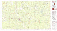
1984 Map of Waynesboro
USGS Topo · Published 1984About this map
The Chickasawhay River and the Tombigbee River define the hydraulic landscape of this borderland in the mid-1980s, where the pine forests of eastern Mississippi meet the timberlands of western Alabama. Centered on Waynesboro, the map illustrates a region deeply connected to the timber and rail industries. The Illinois Central Gulf Railroad runs a north-south line through established timber towns like Shubuta and Buckatunna, while the Burlington Northern Railroad services the eastern reaches near Silas and Cullomburg.
Find a feature on this map
108 named features on this map. Tap any name to fly to it.
Don’t see what you’re looking for? This feature index may not catch every label — zoom into the map to look around manually.
Map Details
Editions of this 1984 Waynesboro Map
2 editions found
Other maps of this area

1943 · Choctaw Bluff
USGS Topo · 1:62,500

1943 · McIntosh
USGS Topo · 1:62,500

1944 · McIntosh
USGS Topo · 1:62,500

1946 · Choctaw Bluff
USGS Topo · 1:62,500

1953 · Montgomery
USGS Topo · 1:250,000

1953 · Andalusia
USGS Topo · 1:250,000

1953 · Hattiesburg
USGS Topo · 1:250,000

1953 · Meridian
USGS Topo · 1:250,000

1956 · Montgomery
USGS Topo · 1:250,000

1957 · Meridian
USGS Topo · 1:250,000