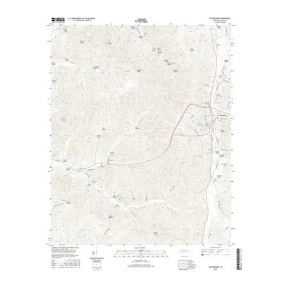
2016 Map of Waynesboro
USGS Topo · Published 2016About this map
Waynesboro serves as the central hub of this Wayne County landscape, where the Green River and its numerous tributaries have carved a dense network of ridges and hollows. The settlement pattern follows the narrow valley floors and upland ridges, connected by historic routes like the Clifton Tpke and Old Beech Creek Rd. This area is particularly dense with family and community burial sites, many located in isolated hollows such as Ray Hollow and Johnson Hollow, reflecting generations of rural settlement. Landmarks like Rocky Mill Br and Hog Cr indicate a long history of water-driven utility in the region. The topography is dominated by local named features such as Copeland Ridge and Wildcat Hollow, illustrating the deeply dissected nature of the Highland Rim. Genealogists will find a wealth of specific family-named locations, from the Greeson Family Cem to the Bennett Cole Cem, scattered across the winding creeks and timbered slopes.
Find a feature on this map
98 named features on this map. Tap any name to fly to it.
Don’t see what you’re looking for? This feature index may not catch every label — zoom into the map to look around manually.
Map Details
Editions of this 2016 Waynesboro Map
This is the sole edition of this map. No revisions or reprints were ever made.
Other maps of this area

1905 · Waynesboro
USGS Topo · 1:125,000

1936 · Collinwood
USGS Topo · 1:24,000

1936 · Eagle Creek
USGS Topo · 1:24,000

1936 · Leatherwood
USGS Topo · 1:24,000

1936 · Negro Hollow
USGS Topo · 1:24,000

1936 · Clifton
USGS Topo · 1:24,000

1936 · Three Churches
USGS Topo · 1:24,000

1936 · Waynesboro
USGS Topo · 1:24,000

1936 · Martins Mills
USGS Topo · 1:24,000

1936 · Topsy
USGS Topo · 1:24,000