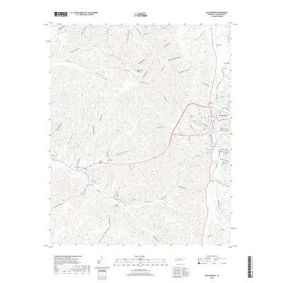
2019 Map of Waynesboro
USGS Topo · Published 2019About this map
Waynesboro serves as the focal point of this Wayne County landscape, situated where the Green River meets a network of hollows and ridges. The town's historic core is marked by the Greenwood Cem and Old Town Cem, while the surrounding countryside is densely populated with family burial grounds that speak to generations of local settlement. Numerous small hollows like Negro Hollow and Grover Hollow carve through the terrain, illustrating the traditional upland south pattern of community development along creek bottoms and sheltered valleys.
Find a feature on this map
108 named features on this map. Tap any name to fly to it.
Don’t see what you’re looking for? This feature index may not catch every label — zoom into the map to look around manually.
Map Details
Editions of this 2019 Waynesboro Map
This is the sole edition of this map. No revisions or reprints were ever made.
Other maps of this area

1905 · Waynesboro
USGS Topo · 1:125,000

1936 · Collinwood
USGS Topo · 1:24,000

1936 · Eagle Creek
USGS Topo · 1:24,000

1936 · Leatherwood
USGS Topo · 1:24,000

1936 · Negro Hollow
USGS Topo · 1:24,000

1936 · Clifton
USGS Topo · 1:24,000

1936 · Three Churches
USGS Topo · 1:24,000

1936 · Waynesboro
USGS Topo · 1:24,000

1936 · Martins Mills
USGS Topo · 1:24,000

1936 · Topsy
USGS Topo · 1:24,000