
1936 Map of Waynesboro
USGS Topo · Published 1936About this map
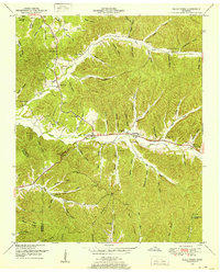
Waynesboro serves as the focal point of this 1930s landscape, where the Green River and State Highway No 64 intersect in the Tennessee hills. The mapping reveals a rural social structure anchored by small community nodes such as Hardin and Shakerag, each supported by local institutions like Leatherwood Sch and Ray Sch. The presence of the County Farm and the Waynesboro Fire Tower indicates the era's civic infrastructure and resource management priorities. This Tennessee Valley Authority collaboration documents the region just as electrification was expanding, evidenced by the Tennessee Electric Power Company Transmission Line cutting across the terrain. Numerous family-named hollows and cemeteries like Morris Cem provide essential data for tracing local lineage and early 20th-century settlement patterns.
Find a feature on this map
51 named features on this map. Tap any name to fly to it.
Don’t see what you’re looking for? This feature index may not catch every label — zoom into the map to look around manually.
Map Details
Editions of this 1936 Waynesboro Map
This is the sole edition of this map. No revisions or reprints were ever made.
Other maps of this area

1905 · Waynesboro
USGS Topo · 1:125,000

1936 · Collinwood
USGS Topo · 1:24,000

1936 · Eagle Creek
USGS Topo · 1:24,000

1936 · Leatherwood
USGS Topo · 1:24,000

1936 · Negro Hollow
USGS Topo · 1:24,000

1936 · Clifton
USGS Topo · 1:24,000

1936 · Three Churches
USGS Topo · 1:24,000

1936 · Martins Mills
USGS Topo · 1:24,000

1936 · Topsy
USGS Topo · 1:24,000
1949 · Eagle Creek
USGS Topo · 1:24,000