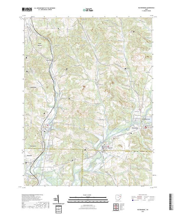
2023 Map of Waynesburg
USGS Topo · Published 2023About this map
Nimishillen Creek and Sandy Creek converge in this corner of Ohio, where the borders of Stark, Tuscarawas, and Carroll counties meet. The landscape is defined by its transition from the valley floor to the elevations of Sponsellers Hill, with numerous small tributaries like Hypocrite Run and Indian Run carving through the terrain. For genealogical researchers, the map is particularly dense with burial sites, documenting family and community history through locations such as Mount Zion Cem, Swift Bachtel Cem, and Farber - Knotts Cem.
Find a feature on this map
130 named features on this map. Tap any name to fly to it.
Don’t see what you’re looking for? This feature index may not catch every label — zoom into the map to look around manually.
Map Details
Editions of this 2023 Waynesburg Map
This is the sole edition of this map. No revisions or reprints were ever made.
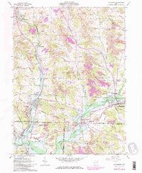
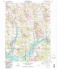
Historical Maps of Magnolia Through Time
3 maps found