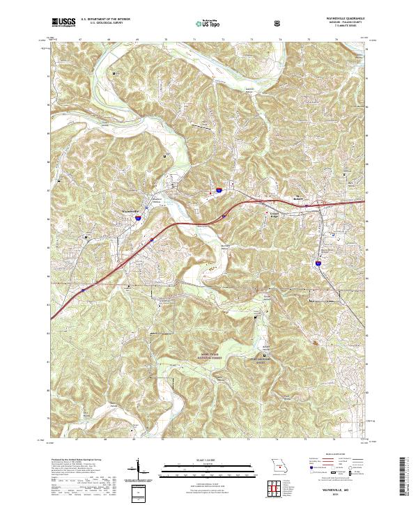
2021 Map of Waynesville
USGS Topo · Published 2021About this map
Waynesville and St. Robert serve as the primary hubs in this Pulaski County landscape, situated where the terrain transitions toward the rugged boundaries of the Mark Twain National Forest. The map documents a corridor heavily influenced by modern transport and military presence, featuring the extensive grounds of Fort Leonard Wood and the Missouri State Veterans Cem Fort Leonard Wood. Traces of the region's automotive heritage remain visible along Old Rte 66, while the natural topography is defined by the winding paths of the Gasconade River and Roubidoux Creek. Numerous family cemeteries, such as Turpin Cem, Rayle Cem, and Morgan Cem, are scattered throughout the hollows, offering a detailed record for genealogists studying the area's older rural settlements and family homesteads.
Find a feature on this map
137 named features on this map. Tap any name to fly to it.
Don’t see what you’re looking for? This feature index may not catch every label — zoom into the map to look around manually.
Map Details
Editions of this 2021 Waynesville Map
This is the sole edition of this map. No revisions or reprints were ever made.
Other maps of this area

1936 · Waynesville
USGS Topo · 1:48,000

1941 · Big Piney
USGS Topo · 1:62,500

1942 · Waynesville
USGS Topo · 1:62,500

1943 · Richland
USGS Topo · 1:62,500

1943 · Big Piney
USGS Topo · 1:62,500

1943 · Drynob
USGS Topo · 1:62,500

1944 · Waynesville
USGS Topo · 1:62,500

1954 · Springfield
USGS Topo · 1:250,000
1954 · Hancock
USGS Topo · 1:24,000

1954 · Drynob
USGS Topo · 1:62,500