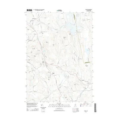
2015 Map of Weare
USGS Topo · Published 2015About this map
North Weare, Weare, and South Weare anchor this mid-2010s survey of southern New Hampshire, where the landscape is defined by the winding course of the Piscataquog River. The river's influence on local industry and settlement is evident near Riverdale and Parker, where the South Branch and Middle Branch converge. Historically significant burial grounds, such as Quaker Cem, Pine Grove Cem, and Stark Cem, are scattered across the terrain, offering vital touchpoints for genealogical research.
Find a feature on this map
135 named features on this map. Tap any name to fly to it.
Don’t see what you’re looking for? This feature index may not catch every label — zoom into the map to look around manually.
Map Details
Editions of this 2015 Weare Map
This is the sole edition of this map. No revisions or reprints were ever made.
Other maps of this area

1900 · Peterboro
USGS Topo · 1:62,500

1906 · Milford
USGS Topo · 1:62,500

1926 · Hillsboro
USGS Topo · 1:62,500

1927 · Concord
USGS Topo · 1:62,500

1929 · Hillsboro
USGS Topo · 1:62,500

1943 · Fitchburg
USGS Topo · 1:125,000

1948 · Boston
USGS Topo · 1:250,000

1949 · Portland
USGS Topo · 1:250,000

1949 · Concord
USGS Topo · 1:62,500
1953 · Peterborough
USGS Topo · 1:62,500