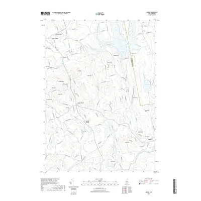
2018 Map of Weare
USGS Topo · Published 2018About this map
The Piscataquog River and its multiple branches define the rugged topography of this Hillsborough County landscape, carving through a series of significant heights like Mt William, Mt Wallingford, and Raymond Cliff. The central corridor is anchored by a string of historic villages, from North Weare and Chase Village down to South Weare and Tavern Village. This settlement pattern reflects the traditional New England mill-and-farm economy, where community centers grew alongside reliable water power and crossroads.
Find a feature on this map
137 named features on this map. Tap any name to fly to it.
Don’t see what you’re looking for? This feature index may not catch every label — zoom into the map to look around manually.
Map Details
Editions of this 2018 Weare Map
This is the sole edition of this map. No revisions or reprints were ever made.
Other maps of this area

1900 · Peterboro
USGS Topo · 1:62,500

1906 · Milford
USGS Topo · 1:62,500

1926 · Hillsboro
USGS Topo · 1:62,500

1927 · Concord
USGS Topo · 1:62,500

1929 · Hillsboro
USGS Topo · 1:62,500

1943 · Fitchburg
USGS Topo · 1:125,000

1948 · Boston
USGS Topo · 1:250,000

1949 · Portland
USGS Topo · 1:250,000

1949 · Concord
USGS Topo · 1:62,500
1953 · Peterborough
USGS Topo · 1:62,500