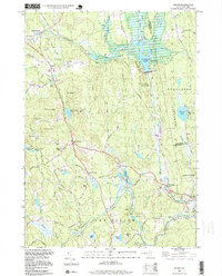
1995 Map of Weare
USGS Topo · Published 1999About this map
The Piscataquog River carves through this central New Hampshire landscape, anchored by the massive Everett Dam and the waters of Everett Lake. This area of Hillsborough County is defined by its small villages and historic burial grounds, including the Quaker Cem near North Weare and the Stark Cem to the northeast. An Old Railroad Grade traces a path through the valley, marking the former transportation corridor that once linked settlements like Chase Village, Riverdale, and Tavern Village.
Find a feature on this map
78 named features on this map. Tap any name to fly to it.
Don’t see what you’re looking for? This feature index may not catch every label — zoom into the map to look around manually.
Map Details
Editions of this 1995 Weare Map
This is the sole edition of this map. No revisions or reprints were ever made.
Other maps of this area

1900 · Peterboro
USGS Topo · 1:62,500

1906 · Milford
USGS Topo · 1:62,500

1926 · Hillsboro
USGS Topo · 1:62,500

1927 · Concord
USGS Topo · 1:62,500

1929 · Hillsboro
USGS Topo · 1:62,500

1943 · Fitchburg
USGS Topo · 1:125,000

1948 · Boston
USGS Topo · 1:250,000

1949 · Portland
USGS Topo · 1:250,000

1949 · Concord
USGS Topo · 1:62,500
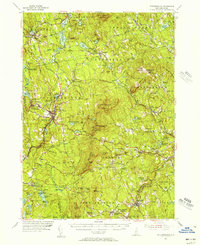
1953 · Peterborough
USGS Topo · 1:62,500