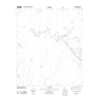
2011 Map of Webb Peak
USGS Topo · Published 2011About this map
Old Columbine and the surrounding high-elevation Pinaleño Mountains landscape are documented in this 2011 survey. The settlement patterns reflect a history of timber and recreation, anchored by the Mount Graham Sawmill and institutional sites like Los Girls Camp. The presence of numerous water sources, including Ash Creek Falls, Goudy Spring, and Emerald Spring, illustrates the critical importance of riparian zones in this arid region. High-country meadows and clearings such as Highwater Cienega, C P Flat, and Peters Flat are interspersed between prominent summits like Webb Peak and Merrill Peak. This edition captures the infrastructure of the Coronado National Forest, from developed areas like Hospital Flat Campground and Riggs Flat Campground to remote landmarks like the Hulda Gap Corral.
Find a feature on this map
55 named features on this map. Tap any name to fly to it.
Don’t see what you’re looking for? This feature index may not catch every label — zoom into the map to look around manually.
Map Details
Editions of this 2011 Webb Peak Map
This is the sole edition of this map. No revisions or reprints were ever made.
Other maps of this area

1940 · Sierra Bonita Ranch
USGS Topo · 1:62,500

1942 · Sierra Bonita Ranch
USGS Topo · 1:62,500

1942 · Mt. Graham
USGS Topo · 1:62,500

1943 · Sierra Bonita Ranch
USGS Topo · 1:62,500

1944 · Jackson Mtn.
USGS Topo · 1:62,500

1945 · Mt. Graham
USGS Topo · 1:62,500

1946 · Jackson Mtn.
USGS Topo · 1:62,500

1954 · Silver City
USGS Topo · 1:250,000

1956 · Tucson
USGS Topo · 1:250,000

1958 · Silver City
USGS Topo · 1:250,000