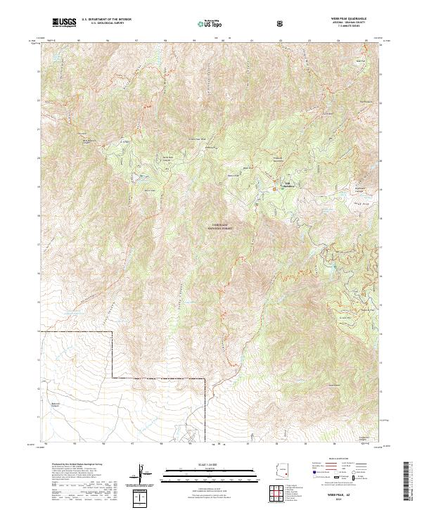
2021 Map of Webb Peak
USGS Topo · Published 2021About this map
The Pinaleno Mountains dominate this high-elevation landscape within the Coronado National Forest, where a complex network of forest trails and water sources sustained early activity in the range. The settlement of Old Columbine is a focal point near the summit of Webb Peak, situated amongst a cluster of high-altitude features including Peters Flat and Chesley Flat. The terrain is deeply incised by numerous canyons, such as Carter Canyon and Ash Creek, which drain the peaks toward the desert floor below.
Find a feature on this map
72 named features on this map. Tap any name to fly to it.
Don’t see what you’re looking for? This feature index may not catch every label — zoom into the map to look around manually.
Map Details
Editions of this 2021 Webb Peak Map
This is the sole edition of this map. No revisions or reprints were ever made.
Other maps of this area

1940 · Sierra Bonita Ranch
USGS Topo · 1:62,500

1942 · Sierra Bonita Ranch
USGS Topo · 1:62,500

1942 · Mt. Graham
USGS Topo · 1:62,500

1943 · Sierra Bonita Ranch
USGS Topo · 1:62,500

1944 · Jackson Mtn.
USGS Topo · 1:62,500

1945 · Mt. Graham
USGS Topo · 1:62,500

1946 · Jackson Mtn.
USGS Topo · 1:62,500

1954 · Silver City
USGS Topo · 1:250,000

1956 · Tucson
USGS Topo · 1:250,000

1958 · Silver City
USGS Topo · 1:250,000