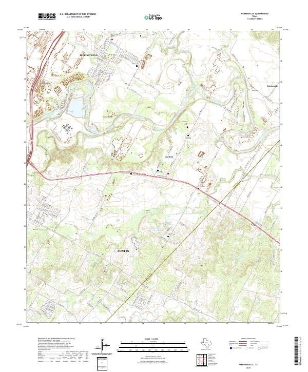
2022 Map of Webberville
USGS Topo · Published 2022About this map
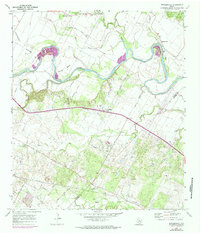
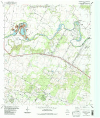
The Colorado River winds eastward through the fertile river bottomlands of Travis Co and Bastrop Co, defining the agricultural character of this landscape south of the Austin metropolitan area. Notable river features include the wide curves at Hornsby Bend and Hunter Bend, while inland, the terrain is marked by significant watercourses like Onion Creek, Gilleland Creek, and Maha Creek. The settlement pattern centers on the unincorporated communities of Garfield and Webberville, where local history is anchored by numerous family and community burial grounds.
Find a feature on this map
102 named features on this map. Tap any name to fly to it.
Don’t see what you’re looking for? This feature index may not catch every label — zoom into the map to look around manually.
Map Details
Editions of this 2022 Webberville Map
This is the sole edition of this map. No revisions or reprints were ever made.
Historical Maps of Dunlap Through Time
3 maps found