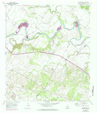
1968 Map of Webberville
USGS Topo · Published 1985About this map
The Colorado River carves deep, dramatic meanders through this landscape on the border of Travis and Bastrop counties, creating the prominent Hornsby Bend and Hunter Bend. These natural horseshoe turns dictated the early settlement patterns of communities like Webberville and Hornsby. The map reveals a high concentration of historical burial sites, including the Comanche Cemeteries and several family-named grounds such as Puckett Cem, Hunter Cem, and Woods Cem, which offer significant value for genealogical research in this rural corridor.
Find a feature on this map
41 named features on this map. Tap any name to fly to it.
Don’t see what you’re looking for? This feature index may not catch every label — zoom into the map to look around manually.
Map Details
Editions of this 1968 Webberville Map
Other maps of this area

1885 · Bastrop
USGS Topo · 1:125,000

1893 · Bastrop
USGS Topo · 1:125,000

1896 · Austin
USGS Topo · 1:125,000

1897 · Austin
USGS Topo · 1:125,000

1904 · Bastrop
USGS Topo · 1:125,000

1910 · Austin
USGS Topo · 1:125,000

1948 · Elgin
USGS Topo · 1:62,500

1948 · Bastrop
USGS Topo · 1:62,500

1950 · Bastrop
USGS Topo · 1:62,500

1950 · Elgin
USGS Topo · 1:62,500