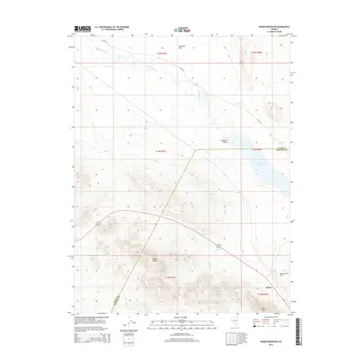
2014 Map of Weber Reservoir
USGS Topo · Published 2014About this map
Schurz serves as a primary point of reference in this arid basin where the Walker River feeds into the Weber Reservoir. The landscape is defined by the sharp elevation changes of the Wassuk Range and the prominent height of White Mtn in the south, contrasting with the open reaches of Sunshine Flat and Campbell Valley. This 2014 survey documents the convergence of modern infrastructure and natural water sources, showing Alt 95 skirting the base of the mountains while Reservation Spring and the drainage at Reservation Hill provide critical hydrology in a desert environment. The boundary between Lyon and Mineral Counties cuts through these high ridges, marking a remote area where the water levels of the reservoir are central to the local geography.
Find a feature on this map
18 named features on this map. Tap any name to fly to it.
Don’t see what you’re looking for? This feature index may not catch every label — zoom into the map to look around manually.
Map Details
Editions of this 2014 Weber Reservoir Map
This is the sole edition of this map. No revisions or reprints were ever made.
Other maps of this area

1891 · Wabuska
USGS Topo · 1:125,000

1891 · Wellington
USGS Topo · 1:125,000

1893 · Wellington
USGS Topo · 1:125,000

1894 · Wabuska
USGS Topo · 1:125,000

1908 · Carson Sink
USGS Topo · 1:250,000

1909 · Hawthorne
USGS Topo · 1:250,000

1910 · Carson Sink
USGS Topo · 1:250,000

1911 · Hawthorne
USGS Topo · 1:250,000

1915 · Hawthorne
USGS Topo · 1:250,000

1948 · Walker Lake
USGS Topo · 1:250,000