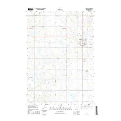
2015 Map of Webster
USGS Topo · Published 2015About this map
Webster sits at the heart of this glacial landscape in Day County, where the sprawling heights of the Coteau des Prairies plateau define the surrounding terrain. This high prairie region is marked by numerous wetlands and water bodies, such as Buchner Slough, which illustrate the complex drainage patterns of the northeast South Dakota plains. The map details the local infrastructure of the mid-2010s, including the grid of the town site and the outlying Sigurd Anderson Airport. Genealogists and local historians will find significant value in the documentation of local burial sites south of the town center, specifically the Webster Cem and Saint Otto's Cem. The surrounding sections are partitioned by a rigorous grid of section-line roads, such as 139th St and 430th Ave, reflecting the enduring township and range system of the rural Midwest.
Find a feature on this map
43 named features on this map. Tap any name to fly to it.
Don’t see what you’re looking for? This feature index may not catch every label — zoom into the map to look around manually.
Map Details
Editions of this 2015 Webster Map
This is the sole edition of this map. No revisions or reprints were ever made.
Other maps of this area

1953 · Milbank
USGS Topo · 1:250,000

1958 · Milbank
USGS Topo · 1:250,000

1970 · Waubay SW
USGS Topo · 1:24,000

1970 · Roslyn
USGS Topo · 1:24,000

1973 · Lily
USGS Topo · 1:24,000

1973 · Lynn Lake
USGS Topo · 1:24,000

1973 · Webster
USGS Topo · 1:24,000

1973 · Swan Lake
USGS Topo · 1:24,000

1973 · Bristol East
USGS Topo · 1:24,000
1973 · Webster NE
USGS Topo · 1:24,000