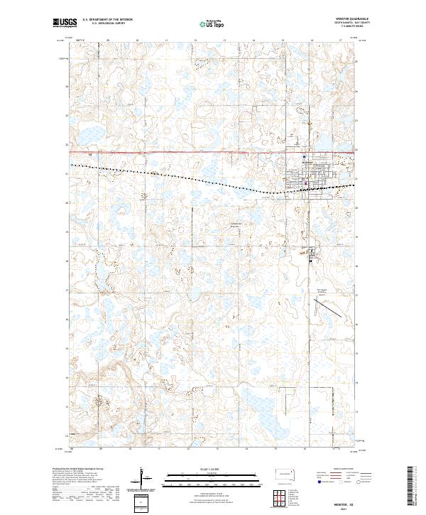
2021 Map of Webster
USGS Topo · Published 2021About this map
Webster serves as the seat of local government, centered around the Day County Courthouse in this high-altitude section of South Dakota. The landscape is defined by the Coteau des Prairies, a vast plateau marked by hundreds of small glacial potholes and wetlands that punctuate the prairie. This 2021 survey documents the established grid of the town, from Main St to the southern reaches near The Sigurd Anderson Airport. Genealogists will find the locations of Webster Cem and Saint Ottos Cem clearly plotted south of the main residential district. The map illustrates a strictly managed agricultural and township grid, where roads like 433rd Ave and Co Rd 23 navigate around the natural depressions of the plateau, showing how modern infrastructure adapts to the irregular hydrography of the region.
Find a feature on this map
52 named features on this map. Tap any name to fly to it.
Don’t see what you’re looking for? This feature index may not catch every label — zoom into the map to look around manually.
Map Details
Editions of this 2021 Webster Map
This is the sole edition of this map. No revisions or reprints were ever made.
Other maps of this area

1953 · Milbank
USGS Topo · 1:250,000

1958 · Milbank
USGS Topo · 1:250,000

1970 · Waubay SW
USGS Topo · 1:24,000

1970 · Roslyn
USGS Topo · 1:24,000

1973 · Lily
USGS Topo · 1:24,000

1973 · Lynn Lake
USGS Topo · 1:24,000

1973 · Webster
USGS Topo · 1:24,000

1973 · Swan Lake
USGS Topo · 1:24,000

1973 · Bristol East
USGS Topo · 1:24,000
1973 · Webster NE
USGS Topo · 1:24,000