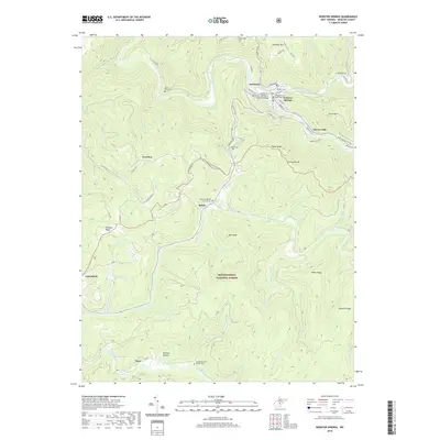
2019 Map of Webster Springs
USGS Topo · Published 2019About this map
Webster Springs serves as the focal point of this highland survey, situated at the confluence of the Elk River and the Back Fork Elk River. The town's civic heart is marked by the Webster County Courthouse, while the surrounding landscape is defined by the steep rises of Payne Knob and Point Mtn. Local infrastructure is anchored by the Kenney-B. Hamrick Sr. Memorial Bridge, facilitating travel across the waterways that historically shaped these mountain communities.
Find a feature on this map
65 named features on this map. Tap any name to fly to it.
Don’t see what you’re looking for? This feature index may not catch every label — zoom into the map to look around manually.
Map Details
Editions of this 2019 Webster Springs Map
This is the sole edition of this map. No revisions or reprints were ever made.
Other maps of this area

1889 · Nicholas
USGS Topo · 1:125,000

1891 · Nicholas
USGS Topo · 1:125,000

1891 · Huntersville
USGS Topo · 1:125,000

1893 · Buckhannon
USGS Topo · 1:125,000

1893 · Sutton
USGS Topo · 1:125,000

1894 · Huntersville
USGS Topo · 1:125,000

1896 · Buckhannon
USGS Topo · 1:125,000

1897 · Buckhannon
USGS Topo · 1:125,000

1901 · Nicholas
USGS Topo · 1:125,000
1908 · Sutton
USGS Topo · 1:48,000
Featured Places
- Webster Springs, Addison (Webster Springs)
- Addison (Webster Springs), WV
- Cherry Falls, WV
- Bolair, WV
- Skidmore Crossing, WV