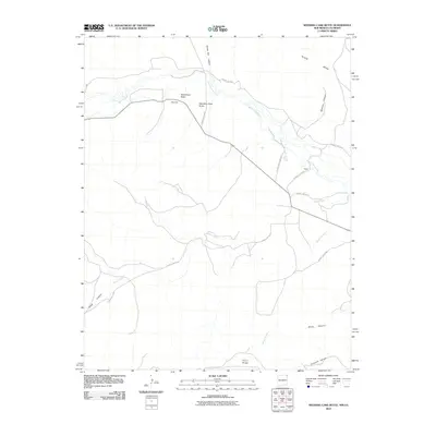
2010 Map of Wedding Cake Butte
USGS Topo · Published 2010About this map
Wedding Cake Butte and the distinctive Shiprock formation rise above the valley of the Dry Cimarron River, characterizing this high-desert landscape on the Colorado and New Mexico border. The 2010 survey illustrates a region defined by its water management and dramatic topography, where the Berry Ditch and South Beheimer Ditch redirect the limited flow of the river to support local land use. This area is sparsely settled, with the small location of Heyen serving as a primary point of reference amidst a network of county highways.
Find a feature on this map
24 named features on this map. Tap any name to fly to it.
Don’t see what you’re looking for? This feature index may not catch every label — zoom into the map to look around manually.
Map Details
Editions of this 2010 Wedding Cake Butte Map
This is the sole edition of this map. No revisions or reprints were ever made.
Other maps of this area

1892 · Mt Carrizo
USGS Topo · 1:125,000

1954 · Dalhart
USGS Topo · 1:250,000

1955 · La Junta
USGS Topo · 1:250,000

1958 · La Junta
USGS Topo · 1:250,000

1958 · Dalhart
USGS Topo · 1:250,000

1962 · Dalhart
USGS Topo · 1:250,000

1968 · La Junta
USGS Topo · 1:250,000
1972 · Wedding Cake Butte
USGS Topo · 1:24,000

1972 · Cuates School
USGS Topo · 1:24,000
1972 · Goodson School
USGS Topo · 1:24,000