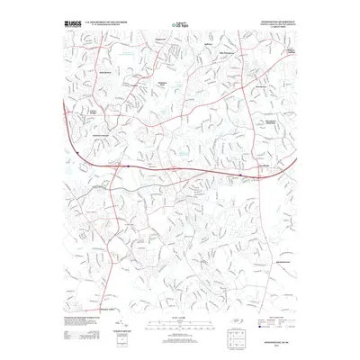
2013 Map of Weddington
USGS Topo · Published 2013About this map
McAlpine Creek and Fourmile Creek carve through this suburban landscape on the North Carolina-South Carolina border, reflecting the rapid residential development south of Charlotte in the early 21st century. The map shows a dense network of neighborhoods including Quail Hollow, Raintree, and Providence Plantation, each defined by winding residential streets and local water features like Lake Providence and Varda Lake. The presence of established communities such as Weddington and Pleasant Valley highlights the transition from traditional rural crossroad settlements to modern residential hubs. Notable landmarks for local history and genealogy include Olde Providence and the Quail Hollow Country Club Lake, while the local hydrology is marked by smaller tributaries like Sixmile Creek and McBride Branch. Major thoroughfares such as Providence Road and Ardrey Kell Road provide the primary framework for the area's growth and connectivity.
Find a feature on this map
40 named features on this map. Tap any name to fly to it.
Don’t see what you’re looking for? This feature index may not catch every label — zoom into the map to look around manually.
Map Details
Editions of this 2013 Weddington Map
This is the sole edition of this map. No revisions or reprints were ever made.
Other maps of this area

1905 · Charlotte
USGS Topo · 1:48,000

1907 · Charlotte
USGS Topo · 1:62,500

1941 · Charlotte
USGS Topo · 1:125,000

1941 · Spartanburg
USGS Topo · 1:250,000

1942 · Charlotte
USGS Topo · 1:125,000

1948 · Charlotte East
USGS Topo · 1:24,000

1948 · Charlotte West
USGS Topo · 1:24,000

1949 · Charlotte West
USGS Topo · 1:24,000

1949 · Charlotte East
USGS Topo · 1:24,000

1949 · Wilgrove
USGS Topo · 1:24,000