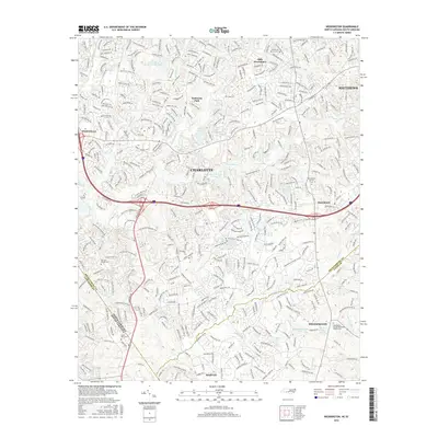
2016 Map of Weddington
USGS Topo · Published 2016About this map
Weddington and Marvin serve as the southern anchors of this suburban landscape, situated along the North Carolina South Carolina border. The map illustrates a dense network of residential development transitioning into the rural-urban fringe of Charlotte. Significant genealogical markers are found in the several established burial grounds across the region, including Harrison Church Cem and the Weddington United Methodist Church Cem. The terrain is defined by a dendritic drainage pattern where McAlpine Cr, McMullen Cr, and Fourmile Cr flow through established neighborhoods and golf courses like the Quail Hollow Country Club Lake. The presence of major thoroughfares such as I-485 and Us-521 highlights the modern connectivity of these outlying communities to the nearby municipalities of Pineville and Matthews.
Find a feature on this map
49 named features on this map. Tap any name to fly to it.
Don’t see what you’re looking for? This feature index may not catch every label — zoom into the map to look around manually.
Map Details
Editions of this 2016 Weddington Map
This is the sole edition of this map. No revisions or reprints were ever made.
Other maps of this area

1905 · Charlotte
USGS Topo · 1:48,000

1907 · Charlotte
USGS Topo · 1:62,500

1941 · Charlotte
USGS Topo · 1:125,000

1941 · Spartanburg
USGS Topo · 1:250,000

1942 · Charlotte
USGS Topo · 1:125,000

1948 · Charlotte East
USGS Topo · 1:24,000

1948 · Charlotte West
USGS Topo · 1:24,000

1949 · Charlotte West
USGS Topo · 1:24,000

1949 · Charlotte East
USGS Topo · 1:24,000

1949 · Wilgrove
USGS Topo · 1:24,000