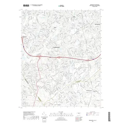
2019 Map of Weddington
USGS Topo · Published 2019About this map
McAlpine Cr and Fourmile Cr weave through a densely suburban landscape where the southern edges of Charlotte meet the rolling transition into Union County. This 2019 survey documents the extensive residential expansion across the North Carolina and South Carolina border, showing the dense network of subdivisions that has transformed former rural lands. Despite the modern development, historical anchors remain visible through several well-preserved religious sites, including the Providence Church Cem and the Murkland Church Cem. The map provides a detailed view of these growing communities, from the established neighborhoods of Olde Providence to the newer developments near Marvin and Weddington. Local landmarks such as the Quail Hollow Country Club Lake and Mitchell Pond Number Six dot the terrain, reflecting the integration of water features and recreational spaces into the modern suburban fabric.
Find a feature on this map
233 named features on this map. Tap any name to fly to it.
Don’t see what you’re looking for? This feature index may not catch every label — zoom into the map to look around manually.
Map Details
Editions of this 2019 Weddington Map
This is the sole edition of this map. No revisions or reprints were ever made.
Other maps of this area

1905 · Charlotte
USGS Topo · 1:48,000

1907 · Charlotte
USGS Topo · 1:62,500

1941 · Charlotte
USGS Topo · 1:125,000

1941 · Spartanburg
USGS Topo · 1:250,000

1942 · Charlotte
USGS Topo · 1:125,000

1948 · Charlotte East
USGS Topo · 1:24,000

1948 · Charlotte West
USGS Topo · 1:24,000

1949 · Charlotte West
USGS Topo · 1:24,000

1949 · Charlotte East
USGS Topo · 1:24,000

1949 · Wilgrove
USGS Topo · 1:24,000