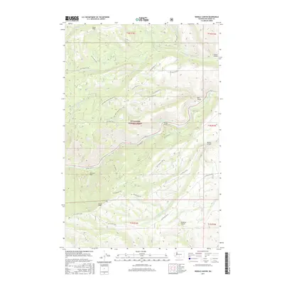
2017 Map of Weddle Canyon
USGS Topo · Published 2017About this map
The Tieton River carves a central path through this section of the Snoqualmie National Forest in Yakima County, flanked by prominent features like Windy Point and Weddle Canyon. The landscape is defined by the high, narrow corridors of Divide Ridge to the south and Horse Ridge to the north, creating a complex drainage network for waterways such as Counterfeit Cr and Tepee Cr. An essential piece of regional water infrastructure, the Yakima-Tieton Main Canal, traces the contours of the river valley, illustrating the engineering required to manage water in this terrain. The map documents an extensive system of forest development roads, including Nat For Dev Rd 410 and Natl Forest Develop Road 1301 Rd, which provide access to remote landmarks like Sentinel Rock and the deep reaches of McDaniel Canyon.
Find a feature on this map
41 named features on this map. Tap any name to fly to it.
Don’t see what you’re looking for? This feature index may not catch every label — zoom into the map to look around manually.
Map Details
Editions of this 2017 Weddle Canyon Map
This is the sole edition of this map. No revisions or reprints were ever made.
Other maps of this area

1899 · Ellensburg
USGS Topo · 1:125,000

1901 · Ellensburg
USGS Topo · 1:125,000

1902 · Mount Aix
USGS Topo · 1:125,000

1904 · Mt Aix
USGS Topo · 1:125,000

1950 · Yakima
USGS Topo · 1:250,000

1958 · Yakima
USGS Topo · 1:250,000

1961 · Yakima
USGS Topo · 1:250,000

1967 · Tieton Basin
USGS Topo · 1:24,000
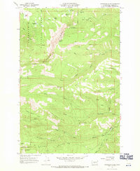
1967 · Foundation Ridge
USGS Topo · 1:24,000

1971 · Nile
USGS Topo · 1:24,000