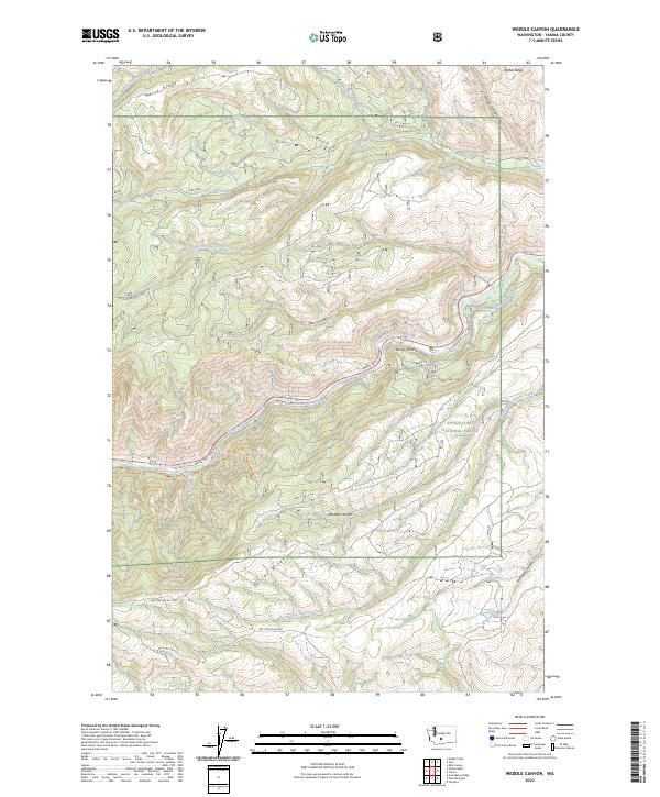
2023 Map of Weddle Canyon
USGS Topo · Published 2023About this map
The Snoqualmie National Forest dominates this landscape of high ridges and canyon systems in Washington's Yakima County. The terrain is structured by massive geographic features such as Divide Ridge to the south and Horse Ridge and Bethel Ridge to the north, creating a complex drainage network for waterways like Oak Creek and South Fork Oak Creek. Central to the map's character is the Tieton River, which is paralleled by both the White Pass Highway and the Yakima-Tieton Main Canal. This engineering feat illustrates the critical role of water management in the region's development, as the canal follows the steep contours of the valley near Windy Point and Bear Canyon. Recreational and management access is represented by routes like Cow Canyon Trl and various forest development roads, providing a view of this highland territory in the early 2020s.
Find a feature on this map
28 named features on this map. Tap any name to fly to it.
Don’t see what you’re looking for? This feature index may not catch every label — zoom into the map to look around manually.
Map Details
Editions of this 2023 Weddle Canyon Map
This is the sole edition of this map. No revisions or reprints were ever made.
Other maps of this area

1899 · Ellensburg
USGS Topo · 1:125,000

1901 · Ellensburg
USGS Topo · 1:125,000

1902 · Mount Aix
USGS Topo · 1:125,000

1904 · Mt Aix
USGS Topo · 1:125,000

1950 · Yakima
USGS Topo · 1:250,000

1958 · Yakima
USGS Topo · 1:250,000

1961 · Yakima
USGS Topo · 1:250,000

1967 · Tieton Basin
USGS Topo · 1:24,000
1967 · Foundation Ridge
USGS Topo · 1:24,000

1971 · Nile
USGS Topo · 1:24,000