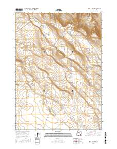
2017 Map of Weed Lake Butte
USGS Topo · Published 2017About this map
The arid high-desert landscape of Harney County is defined here by a network of water collection points and ephemeral lakes essential for land management. Weed Lake Butte rises as a prominent landmark in the northeast, overlooking a terrain punctuated by strategically placed resources like the Weed Lake Butte Waterhole and State Game Waterhole. The map illustrates a reliance on man-made water storage, with several large basins including Campbell Reservoir, Upper Walker Reservoir, and Upper Butler Reservoir situated across the eastern sections. These features, along with the numerous namesake waterholes like Antelope Waterhole and Washpan Lake Waterhole, indicate a working landscape shaped by ranching or conservation needs in a region where surface water is seasonal or scarce. Notable natural depressions such as Marter Lake, Prentis Lake, and the expansive Prentis Draw reveal the underlying hydrology of this section of Oregon.
Find a feature on this map
23 named features on this map. Tap any name to fly to it.
Don’t see what you’re looking for? This feature index may not catch every label — zoom into the map to look around manually.
Map Details
Editions of this 2017 Weed Lake Butte Map
This is the sole edition of this map. No revisions or reprints were ever made.
Other maps of this area

1955 · Burns
USGS Topo · 1:250,000

1955 · Adel
USGS Topo · 1:250,000

1957 · Adel
USGS Topo · 1:250,000

1958 · Burns
USGS Topo · 1:250,000

1958 · Adel
USGS Topo · 1:250,000

1959 · Burns
USGS Topo · 1:250,000

1962 · Adel
USGS Topo · 1:250,000

1971 · Clover Swale
USGS Topo · 1:24,000
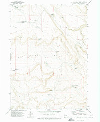
1971 · Keg Sprs Valley East
USGS Topo · 1:24,000
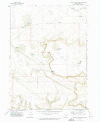
1971 · Keg Sprs Valley West
USGS Topo · 1:24,000