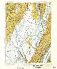
1940 Map of Weehawken
USGS Topo · Published 1940About this map
Bendix Airport and the sprawling industrial facility of Bendix Aviation dominate the central meadows in this 1930s survey of the New Jersey Meadowlands. This pre-war landscape shows the intricate drainage of the Hackensack River and Passaic River before mid-century development transformed the region. The transition from industrial corridors to marshland is stark, with the Erie RR and Pennsylvania RR cutting through the soft ground of Eight Day Swamp and Walden Swamp. To the south, the massive institutional presence of the Hudson County Penitentiary and Hudson County Hospital occupies the area near Snake Hill. Along the Hudson River, the dense urban grids of Weehawken and Union City contrast with the rail yards and the West Shore Terminal on the waterfront, reflecting the era's heavy reliance on rail-to-ferry transport.
Find a feature on this map
110 named features on this map. Tap any name to fly to it.
Don’t see what you’re looking for? This feature index may not catch every label — zoom into the map to look around manually.
Map Details
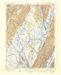
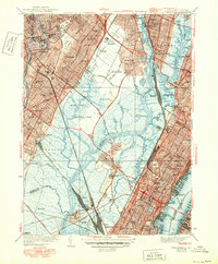
Editions of this 1940 Weehawken Map
3 editions found
Other maps of this area

1888 · Paterson
USGS Topo · 1:62,500

1889 · Brooklyn
USGS Topo · 1:62,500

1891 · Brooklyn
USGS Topo · 1:62,500

1891 · Harlem
USGS Topo · 1:62,500

1892 · Paterson
USGS Topo · 1:62,500

1897 · Harlem
USGS Topo · 1:62,500

1897 · Brooklyn
USGS Topo · 1:62,500

1898 · Harlem
USGS Topo · 1:62,500

1898 · Staten Island
USGS Topo · 1:62,500

1898 · Brooklyn
USGS Topo · 1:62,500