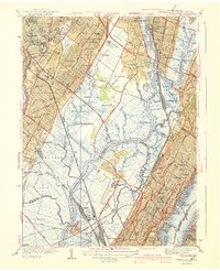
1940 Map of Weehawken
USGS Topo · Published 1940About this map
Industrial corridors and expansive tidal wetlands define this 1940 landscape between the Passaic River and the Hudson River. The Hackensack River winds through a vast marshy basin containing Eight Day Swamp and Walden Swamp, creating a natural barrier between the upland residential developments of Hasbrouck Heights and the dense urban grid of Union City. This era is characterized by massive transportation and aviation infrastructure, anchored by Bendix Airport and the sprawling rail networks of the Erie RR and Pennsylvania RR.
Find a feature on this map
125 named features on this map. Tap any name to fly to it.
Don’t see what you’re looking for? This feature index may not catch every label — zoom into the map to look around manually.
Map Details
Editions of this 1940 Weehawken Map
3 editions found
Other maps of this area

1888 · Paterson
USGS Topo · 1:62,500

1889 · Brooklyn
USGS Topo · 1:62,500

1891 · Brooklyn
USGS Topo · 1:62,500

1891 · Harlem
USGS Topo · 1:62,500

1892 · Paterson
USGS Topo · 1:62,500

1897 · Harlem
USGS Topo · 1:62,500

1897 · Brooklyn
USGS Topo · 1:62,500

1898 · Harlem
USGS Topo · 1:62,500

1898 · Staten Island
USGS Topo · 1:62,500

1898 · Brooklyn
USGS Topo · 1:62,500