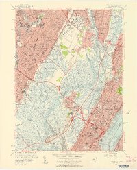
1955 Map of Weehawken
USGS Topo · Published 1958About this map
Industrial corridors and dense urban centers dominate this mid-century landscape along the Hackensack River and Hudson River. In the mid-1950s, the Meadowlands were still defined by expansive wetlands like Eight Day Swamp and Walden Swamp, even as massive infrastructure projects like the New Jersey Turnpike and the approaches to the Lincoln Tunnel and Holland Tunnel carved through the terrain. The map captures a moment of intense rail activity at the Secaucus Yards and the Days Pt West Shore Terminal, serving a region packed with parochial institutions such as St Michaels Monastery and Holy Rosary Academy. Small settlements like Babbitt and New Durham appear alongside larger hubs like Jersey City and Hoboken, revealing the tight-knit residential and industrial grid before the era of late-century redevelopment.
Find a feature on this map
121 named features on this map. Tap any name to fly to it.
Don’t see what you’re looking for? This feature index may not catch every label — zoom into the map to look around manually.
Map Details
Editions of this 1955 Weehawken Map
2 editions found
Other maps of this area

1888 · Paterson
USGS Topo · 1:62,500

1889 · Brooklyn
USGS Topo · 1:62,500

1891 · Brooklyn
USGS Topo · 1:62,500

1891 · Harlem
USGS Topo · 1:62,500

1892 · Paterson
USGS Topo · 1:62,500

1897 · Harlem
USGS Topo · 1:62,500

1897 · Brooklyn
USGS Topo · 1:62,500

1898 · Harlem
USGS Topo · 1:62,500

1898 · Staten Island
USGS Topo · 1:62,500

1898 · Brooklyn
USGS Topo · 1:62,500